Sea kayak tour reports
Photos are linked to this text, but if you prefer you
can look at the photos separately in the gallery.
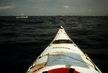 This is classic paddling territory - thousands of islands from tiny rocks to
kilometer-long communities, gradually getting less packed as one heads off
into the Baltic proper. Depending on desire, ability and weather,
you can choose between the safe, densely-packed inner skärgård, the
open, empty, outer islands, or indeed carry on to Åland and ultimately
Finland. Although conditions can get tough (witness The Estonia), the Baltic
is certainly tamer than real oceans, often being quite flat and never having
troublesome tides or currents. The low salinity makes life a little more
comfortable too.
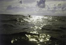 As an intermediate paddler I chose the compromise of rounding the islands
of Svartlöga and Rödlöga, an easy weekend trip of 30km
in the mellanskärgård. We rented two Finnish Artisans (my favorite
sea kayaks) from Svima Sport in Stockholm (08-730-2210) and took 4 hours to
drive the 80km to Bromskär harbour on Blidö (Blå Kartan 117,
SG E167910 , N661580). Here you find fairly safe parking and an easy put in.
Averaging 20km per hour was due to city traffic followed by small country roads. Next time I will
rent the boats in Uppsala for half the price, and drive directly there.
The summer had been good, and it was a beautiful, balmy August evening
with 2-3 m/s wind as we achieved the perpetually amazing feat of stuffing
all the food, water and equipment into our little boats.
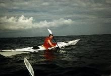 Once on the water we had enough waves to keep our attention, but not enough
to be uncomfortable, and we had a wonderful 2-hour crossing to Labbkobb,
just north of Svartlöga.
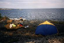
A free-standing tent is invaluable on these rocks, and we put up ours in a
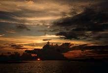
little moss-filled hollow and watched the sun sink down behind the mainland
after dinner. It was the perfect beginning to a kayak trip.
The rain came around 4am, but didn't fill our mossy hollow until at least 5.
We got up to dampness, greyness, and wind. Ugly. But since we had both packed
our stubborness, we set off to round Rödlöga as planned, albeit with
unplanned 0.5m waves that obscured the horizon for us.
 Any other year I would
have cried off, but with the water temperature over 15 deg, I felt confident
of surviving a capsize, something I'm less sure of in more typical Swedish
conditions. The first hour was fun, then we could relax in the lee of the
island and our adrenaline levels sank. We had planned to camp there, but it
was such miserable weather, and the chances of worse the next day were high,
so we decided to paddle back closer to the mainland in order to avoid
getting stuck there. It was a long 2 hours, battling the water and the
navigational difficulties.
 The Baltic coast is so flat and so littered with
indistinguishable rocks that paddling a 10km crossing by compass is a very
uncertain procedure. These difficulties have been a limiting factor in other
trips, which is why I have now invested in a GPS receiver, which in future I
will have packed away for when conventional methods fail.
Incidentally, we carried both the Swedish Blå Kartan (1:100K)
and sea chart 612 (1:50K), but the latter didn't really give much more to us
as kayakers.
We eventually reached Söderröra, just a couple of kilometers from
the car, at which point the skies cleared and it was obvious that the
wonderful summer was going to continue now that we had to get our boats back
early the next morning.
It was a typical Swedish summer trip, disappointing mostly because the weeks
of perfect weather had made us hope for more. I do love Sweden and its nature,
but it has to be admitted that the summer weather is a tad unreliable.
Trip 1: July 1999
This trip was chosen because of its ease of access from Uppsala, just over
an hour of easy driving to the put in at Räfsnäs (also spelled
Rävsnäs on some maps), and because the islands had recently been
freed of their military-secret status, thus allowing us foreigners
to visit a previously taboo area.
We loaded the boats at the slipway by the quaint little harbour
(Blå Kartan 117, SG E1684159 N6630432), and parked the car at the pay-and-display car park
hidden 200m back up the road. Look out for it as you drive in, as parking at
the harbour is all private.
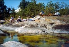 The only single boats left for rent at Friluftsfrämjandet in Uppsala had been tiny -
an Eskimo for me,
so I was glad that the weather forecast was excellent, and I didn't need to
pack extra warm dry clothes and thick sleeping bags.
As we set off at 6pm it was 25° and sunny, but blowing 5-10m/s from
the south, so we headed north of Tjockö to get some protection from wind and waves.
From looking at the map, we had thought that the island Plomman looked suitably
isolated, but from a chance encounter with a pair of paddlers in the car park
(OK, not really chance, I pretty much dragged them out of the car in the hope
of getting some local info. Thanks guys, you saved our weekend) we learned that
Plomman is a Mecca for day-tripping motor-boaters, so our goal was now for something
further out, beyond Gisslingö.
The water was an amazing 16°, so unafraid of a capsize, I happily surfed
some of the bigger waves that came by as we crossed the first, exposed, sound.
Life was good.
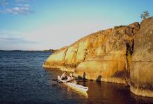 After just 90 minutes we were 8km out, and the bigger islands were behind us,
giving me my much needed fix of open sea, even though most of the horizon was
dotted with islands. It had been an easy paddle except for one channel
that broke our protection, and funnelled the wind broadside to us,
reminding us of what it would have been all the way if we'd stuck with Plomman
as a goal.
Navigation was more difficult than in the open waters further south, and
for once I was very glad that we had a sea chart as well as a land topo.
Out here you are pretty spoiled for camping spots, with easy landing, protection,
and views everywhere. Flat spots to pitch our tents out of vegetation
were slightly more limited, but not much, and despite being a beautiful
weekend in July, there were very few other boats about.
I do so love the fact that no-one lives in Sweden.
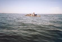 The island we chose had no name on the chart, but is just east of Trångan
(SG E1691004 N6629552). We set up our tents facing out over the shipping lane,
and since it was after 9pm, I used my emergency dinner that I had been
carrying for years, never using it in case I had a real emergency.
The idea of missing a perfect sunset while cooking finally qualified.
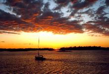 Huge ships on their way to Finland passed a few hundred meters away and caused a slight swell
on our beach, but we had carried the boats many meters higher than necessary
and still tied them to a tree.
We awoke to a perfectly clear sky, 25°+, and no wind.
This was the first time that I had ever woken to sun on a kayak trip, and I was
ecstatic as I took a pre-breakfast swim in the crystal clear water.
We chatted and fished fruitlessly (and fishlessly), in no hurry to break the spell.
Eventually we broke camp and pottered north on the mill pond that was the Baltic that morning.
It was all very wonderful, easy, and safe, and we were glad we had kayaks instead of a sailing boat.
Now we were really on open sea,
with an
uncluttered horizon and still very few boats. The sky was still clear
over us, but we could see storms ravaging the mainland. We lunched on a bare rock,
I swam again, and
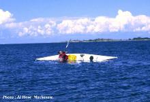
rolled my boat to confirm what I had read in books, that it is
just as easy with 25kg of packing as with an empty boat in a swimming pool,
and it was comforting to find out that it's true. I did some more just because it felt good.
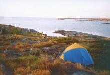 For our next overnight we chose an island marked simply 'Ö' on the chart
(SG E169200 N6634850). Next door is one marked 'V', so Ö
presumably means 'east' rather than 'island'. We parked in the perfect micro-harbour,
and fell asleep on the sea-polished granite for half an hour, at which point the
mainland clouds stretched out a finger to us, and a wind of 10-15 m/s built up
in minutes. Very happy that we weren't still on the water, we searched the island for
a more sheltered camp site, but decided it wasn't worth moving, and that we
would trust our 3-season tents. But during our search we did find that we
weren't alone on the island, but were sharing it with tadpoles and cloudberries.
A lot of thought went into how the frogs/toads survived -20°
in the winter, with only a few inches of soil to bury themselves in.
The evening was cool but
beautiful again, and we chatted till midnight by the water,
marvelling at how spoiled we are by unspoiled nature up here.
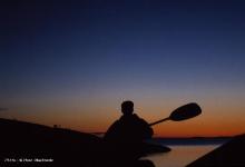
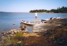 The morning was warm, but still windy, so we made a relatively early start,
worrying that the afternoon sea breeze would add to the awkward but not debilitating 5 m/s that we already had. We headed north of Gisslingö for
protection this time, and by the time we got to the last exposed sound, the
wind had subsided a little, and jubilant of a perfect paddling weekend,
I at least wallowed in the chop and exposure of the last couple of kilometers.
We had had a very pleasant lunch on Norra Lönnskär, where I caught
a healthy-sized but unhealthy-looking pike, which we threw back for something fitter to eat.
We had only travelled about 10km per day, but had come as far out as we needed
to avoid the crowds and feel like we were out to sea, and I would thoroughly
recommend the area for a weekend trip. If you have a week, there is a continuous chain
of islands up to 20km out. And then it's not far to Åland...
We had a good route, good weather, and good company, and the trip gets an
unprecedented rating of 5 paddles out of a possible 5.
Trip 2 : August 2002
This was a rushed trip, leaving Uppsala at 2pm on Friday, and due back Saturday evening,
but the weather was too fantastic to resist getting out to sea even for a short trip.
The hottest summer for 100 years
had put the water temperature up to around 20°C, and it was 25° in the air,
so even a 3-4 m/s north wind in the evening didn't feel too cold. We had rented Prijon Catalina
boats from Connos Kajak in Uppsala (018-291780),
which have a noticeably smaller packing volume (130l) than the Artisans that I am used to (175l),
so it was a struggle to pack, and I nervously left a spare 5l water bottle in the car.
It was 5:30 by the time we launched,
so we couldn't waste any time if we were to get past Gisslingö and out to open water before dark.
We headed out through Tjocköfjärden and Själstensfjärden and then
up between Korsö and Torparö Despite the light wind and conditions that would be
described as 'calm' on the weather report, many of the bigger waves broke over our decks,
and I was glad the water was so warm. A military launch passed us and created a deep bow wave
on which I could surf for several hundred meters. The plastic boat felt a little heavy and unresponsive
compared to an Artisan, but a bigger problem was that I am getting too old to use my big Lendal Powermaster
paddle with a fully-laden kayak, especially in a hurry against a headwind, so my hands hurt and
my shoulders ached for a smaller paddle.
Comfortably before dark and after 8km paddling,
we found the perfect island
just west of Knölskär (SG E1692209 N6632312). 100m long by 50m wide, with a big bush to protect
the tents from the wind, but otherwise open enough to get a good breeze to keep the mosquitos away.
We quickly established camp, and cooked our batchelor dinners that tasted as good as any gourmet
meal with the help of Frederik's bottle of red wine. Then we lay on the bare rock watching the stars
till midnight, talking about batchelor stuff.
The heat of the sun woke me at 7:30 and I tried to sleep on, but I was soon drowning in a pool of sweat.
Still, it was noon by the time we had finished breakfast, and 2 by the time we'd swum and got ourselves
organised. It was hot again, and almost windless, so I cooled off and showed off with regular eskimo rolls.
We returned to Räfsnäs by going north of Gisslingö and Tyvön, and down the
coast parallel to the shipping channel, clocking up another 10km over 5 hours of idle paddling and lunching.
We unloaded the boats, but the weather was so great that we went back out for some training with empty boats.
I managed to make my first ever accidental capsize whilst surfing a bow wave, and as I'd always
feared, my well-practiced screw roll failed to get me up on the first attempt in a real life capsize.
I repositioned for a Pawlata roll, and came up on that. I went over because the wave I was surfing broached
me too much for my stern rudder stroke to support, and since I was already leaning heavily, I didn't have
time to take a breath before going under. As a consequence of that, I think I hurried my screw setup, and
that's probably why it failed.
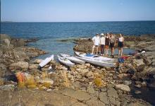 This quick overnighter was organised by half a dozen friends, and the location
was determined by the availability of kayaks at short notice.
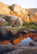 Väddö Vital (Phone 0176-50803,
http://www.hyrkajak.nu) came through with
a collection of VKV boats, and were willing to drive them up to Singö,
since the coast is bereft of islands near Älmsta where they are based.
An alternative would have been to have them taken down to Björkö
and head for Söderarm.
We met up at Singö Camping (Phone 0175-10025, Blå Kartan 116,
SG E1665227 N6673891), and paddled north under a cloudless sky with the temperature
over 25°C. There was a gentle breeze and a slight swell to give wonderful
paddling conditions, but I never got to be complete friends with my Sea Gull Offshore.
It has a huge cockpit that makes it very difficult to grip the boat, especially
if you have short legs as I do, it has no skeg, and a rudder that couldn't be
completely lifted out of the water. Worse still, it handled like an overloaded freighter.
I managed to roll it a couple of times, but only after I'd carefully positioned
my legs before going over.
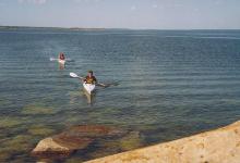 We looked at Måsten as a possible camping spot, but the natural harbour
on the north side made it too popular with bigger craft.
There are several smaller islands in the vicinity, but in contrast to
the flat, glacially-smoothed islands further south, here the rocks
had an east-west slope to them and were heavily fissured, which made it hard to
find a good place for three tents.
Eventually we decided on the north corner of
Stora Korssten (Blå Kartan 126,
SG E1668397 N6680004), and settled there after 10km paddling from Singö.
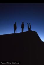 To the north was open sea with just a few islands many kilometers away,
and to the east Åland could just be seen on the horizon.
The evening was spent in the hands of Mother Nature, enjoying the surprising
amount of wildlife on such a small, apparently barren island. We found a hare,
frogs, butterflies, various bugs in the salt and freshwater pools,
hönsbär, juniper, and much more. We watched the
sun set over the
mainland, and then the moon rise over the sea, huge and red. Then mysterious
craft chugged by in the darkness, to merge with the plethora of running
lights in the distance.
The morning was
spectacular again, with flat seas, 25°C in the air
and 16°C in the water, but by lunchtime a sea breeze had developed,
and with it a swell of almost half a meter, which made for fun paddling,
and surfing at over 10 knots.
I can recommend Väddö Vital and this area for a weekend tour,
if you don't mind VKV boats, but I at least would have felt very nervous
if we'd had to deal with rough seas in them, even though I know a Sea Gull
Ocean has been paddled around Cape Horn.
I have made several trips from this island just off the Uppland coast,
2 hours and one ferry from Uppsala, around 3hrs from Stockholm.
Gräsö has its own archipelago of around 20 inhabited islands and
dozens of variously-sized skerries extending out about 10km.
It is quite heavily populated with summer cottages, and public parking on the
outer coast is scarce. The best put in is at Örskärssund harbour at
the far north end of the island, but then it is a long paddle down to the best
islands that are not bird sanctuaries. Otherwise locals have always let me
park on their land if I beg nicely. Tålingen (Blå Kartan 126, SG
E165650 N669750) is a good goal for a weekend trip. I rent from
Friluftsfrämjandet
(018-276086) who have an excellent selection of
boats, but one can also rent from
Kanot Center in Östhammar (0173-21692),
or as a last resort KFUM
in Uppsala (018-324006) who have 3 heavy plastic Sea Lion
Kayaks, which are at least indestructible if you're planning to be swept into
rocks.
This is a starting point for tours in the Norra Björkfjärden
(Blå kartan 105 or sea chart 111).
I'm not sure why I chose this area, but it was years ago after a long hiatus
from paddling, and perhaps I thought it was a safe, sheltered place for a
memory-jogging May trip with some potential paddling partners.
It turned out to be the worst outdoor experience I have ever had, but don't
let that stop you going there. If you want something to stop you going there,
then let it be the high density of nature reservations and bird sancturies.
Well, maybe that's what attracts a lot of people, but it does make camping
difficult. The reservations were marked on our maps, but many of the
sanctuaries took us by surprise after hours of extra paddling in heavy winds
and waves to find an overnighting spot. The easiest places to camp are Stora
and Lilla Gåsholmen, but they are rather big for my taste.
Grässkär is not legally protected, but some aggressive geese
had decided to do something about that oversight.
I'll spare you the horror stories of paddling till 9pm to find a permissible
island, wet sleeping bags, inedible pike, and sudden storms that wrenched at
our paddles and threatened to dump us in the 12 degree water. I'll just say
that we decided against our open-sea trip for which this was a warm up.
This is a very popular paddling spot, and Kajakcenter cater to this by having about 50 boats to rent. We rented their low-budget
plastic Hasle Explorers, which were remarkably well behaved, and I didn't miss having
a high-performance glass-fibre boat for a day. The weather was fine, and we took a leasurely
trip to the exposed outside of Pinnö, without being at all adventurous. If the weather had been heavier,
we could have gone north and been shelterted by islands all the way. But after paddling a lot on the
cosy east coast, it was fun to be out on a real ocean. Even if the waves were small, there was
an appreciable swell to enjoy. I definitely hope to be back for a bigger trip sometime.
A great place to paddle, except for the fact that it's technically forbidden to
camp outside of the official campgrounds.
It's very frustrating to see all these beautiful little rocks just longing to
have a tent sat on them, and it's hard to do so discretely with no trees on
the smaller ones. I don't know how much it happens anyway, or what the
consequences are.
I rented from a guy on one of the outer islands (Vårdö, phone : +358-0-47 750)
who promised me a sea kayak, but in fact had only a VKV Lisa achipelago left.
I know it's sacrilege to say so, but I hated it - I felt so unsafe perched up
on top of it, and they must be impossible to roll, so what you do after
a capsize God only knows, and I got the feeling that I might soon be able
to ask Him directly. If you want a real kayak from this place, get a real
promise when you book.
Some people paddle from Sweden to Åland and on to Finland. This is about
150km all tolled, but there are islands all the way except for a 30km
hop at the beginning. I'd love to do it, but I think I would have to live in
Östhammar with a boat and be ready for a sudden start when perfect
weather presented itself. I can't imagine a pre-planned trip with variable
weather suceeding for me. If you're braver than I am, call Infinite Travel
Adventures on (08)7318812.
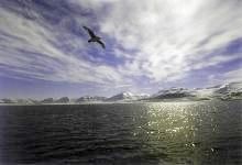 It sounds dramatic, paddling this Norwegian outpost 12 degrees from the
north pole, but in my case I just joined a group of beginners for a day tour
organised by the the local outfitters Svalbard Active Sport who also provided dry suits,
so it was pretty safe. And it was midsummer, so the air temperature
was a heady 4 degrees C. On the previous day's trip the group had met a pod of
whales, and often there is floating ice to negotiate, but we saw no mammals
and the ice had been blown out to sea by easterly winds, so it was an
uneventful but pleasant trip across the bay.
The company uses both single and double plastic kayaks, and if you prefer
one or the other you should let them know when you book.
As with all trips outside the town, someone in the group must carry a
firearm because of the very real polar bear danger. Incidentally, if you
do have to shoot one, make sure it's in self-defence as the authorities
actually do post-mortems to make sure it wasn't for fun, before selling
the meat to the local hotel.
It's hard to describe the islands as beautiful, but they are definitely
dramatic and interesting, and well worth a visit if you find yourself at a
loose end in northern Norway for a weekend. Both SAS and Braathens fly regularly
from Tromsö to Longyearbyn, but SAS fly in the middle of the night,
which rather mucks up a short schedule. Take with you a black bin liner
for your window if you have trouble sleeping in blazing sunshine, as they have
midnight sun with a vengence up there.
You can ski all year round, but I missed that opportunity due to some
unfortunate feuding between the two outfitting companies that are aligned with
different hotels and pensions. My receptionist wouldn't tell me about the
other company even when her's had no corresponding service. Watch out for this.
The waters around Vancouver are classic paddling territory, and it is no
surprise that most of the authors of kayaking books seem to live nearby.
I chose to rent my boat from
North Island Kayaks
(250-949-7707), who operate out of Port Hardy, 500km north of Victoria,
but there are many others to choose from.
I flew into Vancouver and stayed at the
YWCA (604-895-5830),
which is housed in a brand-new
building with hotel standards at hostel prices, and with the best gym I've
ever been to. Stay there.
From Vancouver it's a 2-hour boat ride with
BC Ferries (250-381-1401) to Nanaimo, half way up Vancouver Island, but if you want
to catch the one bus a day to Port Hardy
(Gray Line 250-388-5248),
you have to choose the right day and start at dawn. Alternatively,
Pacific Coastal Air (604-273-8666) fly direct for around twice the price.
Luckily for me, Marc from NIK was driving up that day, so I could take the
lunchtime ferry, and after a stop at the supermarket to buy provisions for the trip,
I was driven in the comfort of his pickup to Alert Bay where his kayaks live.
I spent those four hours grilling him on local conditions, good routes, and fishing tips.
I was particularly interested in tides and currents, since I have been spoiled
by living on the Baltic and have only ever read about such things.
At the bay I was left to share his caravan with 11 kayaks while Marc went
back home to his children. It was midsummer's night, and I celebrated by
sitting on the floor of the campsite laundry and writing letters on the
bottom of a bucket, as the caravan had no lights, and I didn't want to start
using up my torch batteries, having forgotten to buy extras in Nanaimo.
The next morning was sunny and fine, 20°C and 2-3 m/s NW wind,
as I waited for Marc to arrive with the stove and tide tables that I would borrow,
desperate for a cup of tea and ignorant of the microwave in the site office that
could have provided me with one.
At last he arrived, and with the advice that I should stay on the mainland
that night because I wouldn't make the high-tide slack to cross
Blackney Passage in time,
off I went.
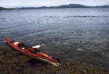 The boat was a Seaward Navigator and very comfortable to handle, but more stable
than I am used to, which might have been a problem in rough conditions, as 'stable' means 'stays parallel with the water surface', which is great in calm weather, not so great with steep waves.
The cockpit was big, which meant having chart and camera on the spray deck,
which made me wonder about entanglement if I should need to wet exit.
I worry a lot. I had about 25kg of equipment, which just about fitted into the
front and back compartments without having to pack too carefully. I wore
shorts and a fleece shirt under my lifejacket, but perhaps should have worn
more in case I fell into the 12° water. I also used a paddle leash for
the first time, and it felt good to have the paddle secure, causing problems
only when I tried to use it as support behind the seat when getting in.
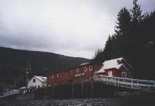 The tide was rising and there was a strong current running south (the chart
reckoned up to 4 knots), so I found myself travelling at 10 kph without much
effort, and reached
Telegraph Cove in about 40 minutes. But I hadn't paddled
for a few weeks, hadn't warmed up on the beach, and had made the mistake
of starting out with a big paddle, so my shoulder joints were suffering
by the time I reached the cove. It's a cute little harbour, and you really have to
stop there even if you're not desperate for caffeine as I was.
But I was also aware that the tide would turn soon, and the current with it,
so I rushed around pretty quickly, visiting the whale watchers office to check on
recent sightings (sparse, being a month early for the resident pods to
be chasing the salmon north), the pub to fill up on coffee and carbohydrates,
and the fishing shop just because it was there. The girl behind the counter
was rather cute, so I suddenly felt that I should check my understanding
of the tide tables. And thank goodness for cute girls - it turned out that
the currents along the Johnstone Strait lag the tides by three hours, not
a few minutes as I had understood from Marc. This meant that my planned
passing of Blackney Passage the next day would have coincided with the heaviest currents and
the worst of the whirlpools and tide rips. Wonderfully nice and friendly as Marc is,
I was beginning to harbour suspicions that he was a little too relaxed about some things.
The girlie gave me copies of the current tables to complement my tide tables,
and I continued down the coast with the smaller reserve paddle and an equally
strong current despite being an hour past high tide.
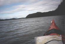
I paddled along past steep, tree-covered cliffs and occasional beaches,
with snow-covered mountains sticking out above the scattered clouds.
All rather nice. Apparently black bears are common here, but I saw none,
and probably low tide is a better time to catch them crabbing.
 I was almost down to Kaikash Cove by 4pm, slack tide. If I had camped there
as planned I would have had to get up very early for the first slack, or wait
all day for the next, so I decided to make a dash for the crossing immediately.
It was probably 30 minutes across to the dodgy area, so I would be a little late, but I thought that it was worth a try, and I could always come back if it were too rough. The wind had picked up by now, as it does most afternoons,
and the current was starting to turn, so waves were building up, but nothing
unmanageable. Well, a couple looked menacing enough for me to head downstream
and backpaddle for, but I was just being cautious. The passage itself was sheltered,
and there was no sign of the tricky hydraulics.
Once past the scary symbols on the chart I relaxed and enjoyed the sunshine
and gentle chop, and was rewarded by the sight of five or six dolphin fins
gracefully sweeping out of the water a couple of hundred meters away.
This was the sort of experience I had come for. I already thought that 4 days
was going to be far too short.
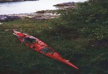 I headed for the sheltered islands of Indian Channel, and stopped at Whitebeach Passage.
It was 6pm and I was starting to feel cold and tired, so I ran around the
beach and ate half a packet of biscuits, which gave me new life.
I paddled another hour looking for a good campsite, which was surprisingly
hard, but I eventually found one near New Vancouver, after a total of 23km paddling.
The tide was coming in quickly, so I pulled the boat up as far as I could
on the sharp rocks with inch-long barnacles, unloaded everything to the
safe-looking grassy bank 10 feet up, then struggled to carry the 25kg boat
even higher, and tied it to two trees. I fished briefly and caught a very ugly
fish. As a great believer in Darwin, I thought that its ugliness was trying
to tell me something, and threw it back. I later learned that it was probably
a tasty greenling. Instead I had tinned salmon with my pasta, and after a
brief walk down the rapidly diminishing beach I went to bed happy,
wondering only briefly where the snake had gone that I disturbed while pitching
the tent, and where the dying otter on the rock below had come from.
I woke to nice enough weather, but the skies looked menacing, so I packed
and breakfasted as fast as I could, and caught the flow tide out and away
towards the old Indian settlement of Village Island.
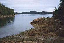
This was another pleasant hour's paddling, but as I arrived it started to rain.
I wanted to see the old totem poles so I stopped anyway, and found one fallen
example before conceding to the overgrown nettles.
 Then paddling became rather tedious, and even with my paddle jacket on
it was hard to keep comfortably warm. Visibility wasn't good, and life wasn't
fun anymore. But one bright spot was watching a bald eagle glide down and
effortlessly pluck a fish from the water.
Squeezing between Crease and Swanson islands I met my first tide rips, and since they
were small and there were fishing boats around, I played in them for a while.
It was easy to see how bigger ones could get you into trouble.
From there I headed across to Hanson Island, and half way through the tedious
crossing I looked down at the chart and idly wondered why it was called
Blackfish Sound, at which point half a dozen dolphin fins appeared alongside me,
maybe 200m away. I kept my course like the books suggest, and then stopped
as the dolphins slowly closed in on me. When they were a few meters away
they started leaping out of the water, some of them doing flips on to their backs.
I never imagined that they would do such things in the wild. After a couple of
minutes they carried on their sedate passge across the bay with occasional
additional bursts of exhuberance. I felt privileged to see them, and couldn't
help feeling that they had put on a show for me.
 Happy again, I carried on and scoured the island for a camping spot,
occasionally watched by curious-looking seals. The site Marc had suggested
had a rusty van and a semi-trailer inexplicably dumped on the beach,
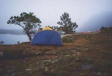
so I kept looking and eventually found a grassy knoll at
Double Bay. 18km for my second day.
But this had steep slippery rocks up from the water, which were a nightmare to
portage up, but mercifully the rain stopped for half an hour while I did it.
Then it returned with a vengence, and I wished I had a better vestibule on my tent
so that I didn't have to cook outside. I used my emergency freeze-dried dinner
to save time, but it turned out that I'd bought a gourmet package that was more
complex to prepare than fresh food.
The night was long and wet, but I had to be up early to catch the slack across
Weynton Passage. Again the rain stopped for loading, but I found my landing beach now had a
3-foot drop into the water, so I would never be able to load the boat in the water,
and I didn't fancy throwing 50kg from the slippery rocks into the roughening seas.
Instead I threw the empty boat in on a line, gingerly climbed in, and paddled
round to a flatter beach for loading. But still it wasn't easy, with the tide
coming in and a considerable swell picking up. I swore a few times as waves
grabbed the boat just as I was trying to seal the lids.
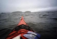 Out on the water I hesitated about continuing. It was very misty (I couldn't
see the mainland 4km away), I didn't know how much worse the waves would get, and I'd lost half an hour loading the boat, so I was going to miss the slack tide.
I resolved to always have an eye on a landable beach, and I was glad to have a
GPS receiver with me to corroborate my
identification of
misty islands. Close to Pearse Island I met some standing waves, but nothing troublesome. I stopped for lunch and a more careful assessment of my
position than I could manage in the boat with a fragmented 10-year old chart.
After one sandwich I lost the rest of my lunch to a freak wave, and started wondering if
I really wanted another night in the rain and an early start with nothing to see
but grey shadows. The answer was no, so I put on waterproof trousers, a
fleece liner under my hat, and marigold gloves, and followed the GPS arrow
across the strait to Alder bay. The current was against me, so I was down
to 2kph at the end. It was pouring with rain by now, and it was clear that
we were in the middle of a depression that wasn't going anywhere soon. So
disappointing as it was to lose a day, I stuffed all my soaking gear into
a bag and fled to the airport where PCA flew me direct to Vancouver in 75 minutes. The bus/boat combo would have got me there 25 hours later.
I had paddled about 50km in total over the 3 days.
So what did I learn ? That I'm lucky to live on the Baltic with insignificant
tides and currents, which are as tricky to predict as they appear from the books.
I knew that currents don't always follow tides, but trusted my outfitter when he said they did here.
I should have made sure that I got current as well as tide tables.
12 foot tides make landing and launching very painful if you don't land and
launch at the same time. If you do leave at a different tide point than you
arrive, you can be surprised by tricky terrain that was under water.
A GPS receiver is great to have in fog and currents. Even when a distant
landfall is visible as an outline, without a transit
it can be misleading to aim for a single landmark across a current.
Just knowing your true speed in a current is very helpful too.
A VHF radio would have been nice to have if I had got into trouble, but Marc's
were all in for repair that week.
If you want to see whales, travelling in July is better, but June is less
crowded (probably not really a problem even later), and there is still
plenty of wildlife about.
The guidebooks make the Johnstone Strait sound like a narrow channel
streaming with traffic, and even describe it as dangerously busy.
I didn't get that impression at all. There was certainly traffic about,
but I didn't find it intrusive, and I'm pretty claustraphobic about such things.
I give the place a rating of 4 paddles out of 5 (reserving one for somewhere
with more reliable weather).
© Mark Harris 1999
(Kayak index)
(Other Sports around Uppsala)
(MRH homepage)

 As an intermediate paddler I chose the compromise of rounding the islands
of Svartlöga and Rödlöga, an easy weekend trip of 30km
in the mellanskärgård. We rented two Finnish Artisans (my favorite
sea kayaks) from Svima Sport in Stockholm (08-730-2210) and took 4 hours to
drive the 80km to Bromskär harbour on Blidö (Blå Kartan 117,
SG E167910 , N661580). Here you find fairly safe parking and an easy put in.
Averaging 20km per hour was due to city traffic followed by small country roads. Next time I will
rent the boats in Uppsala for half the price, and drive directly there.
 This is classic paddling territory - thousands of islands from tiny rocks to
kilometer-long communities, gradually getting less packed as one heads off
into the Baltic proper. Depending on desire, ability and weather,
you can choose between the safe, densely-packed inner skärgård, the
open, empty, outer islands, or indeed carry on to Åland and ultimately
Finland. Although conditions can get tough (witness The Estonia), the Baltic
is certainly tamer than real oceans, often being quite flat and never having
troublesome tides or currents. The low salinity makes life a little more
comfortable too.


